Casablanca: Call for Strengthened Cooperation in the Knowledge and Management of African Maritime Spaces
The African Cooperation Seminar on Hydrography, Oceanography, and Marine Cartography, held from October 8 to 10 in Casablanca, concluded on Friday with a strong call for enhanced cooperation in the understanding and management of African maritime spaces.
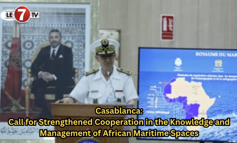
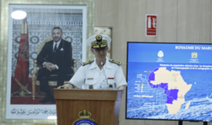
In his closing address at the seminar—organized by the Administration of National Defense and the Royal Navy in execution of the High Instructions of His Majesty King Mohammed VI, may God assist Him, Supreme Commander and Chief of General Staff of the Royal Armed Forces—Rear Admiral Mohamed Tahin, Inspector of the Royal Navy, emphasized that throughout the sessions, participants “clearly and convincingly reaffirmed the strategic imperative of strengthened cooperation in the knowledge and management of our maritime spaces, both at the continental and international levels.”
According to Rear Admiral Tahin, the exchanges and discussions led to the emergence of a shared vision centered on mastering scientific knowledge and taking ownership of it.
“Certainly, this seminar comes to an end, but it does not conclude our joint effort. On the contrary, it opens a new phase of implementation and consolidation,” he continued.
He added that this new phase represents “a mutual commitment to frequent and active participation of our hydrographic services in various meetings at the regional, continental, and international levels, in order to strengthen Africa’s voice and defend this shared vision of sovereignty, inclusion, and ownership of maritime space.”
Echoing the same view, Admiral Ayo Olugbode, Director of the Hydrographic Service of Nigeria, underlined the importance of this seminar as a platform for exchange on African cooperation in the fields of hydrography, oceanography, and marine cartography.
He noted that the event enabled participants to share experiences and knowledge and to engage in in-depth dialogue on the role of hydrographic and oceanographic information in maritime security and the sustainable management of marine resources. He further stressed that hydrography is a central element in any national maritime or coastal development policy.
For his part, Rui Da Silva, Deputy Permanent Representative of Guinea-Bissau to the International Maritime Organization, thanked Morocco for organizing such a major seminar, highlighting that African cooperation in hydrography, oceanography, and cartography requires a common vision.
“By coming together, we were able to discover the best practices of the most advanced African countries in this field, such as Morocco and Nigeria. We can now move forward by supporting one another,” he stated.
The African Cooperation Seminar on Hydrography, Oceanography, and Marine Cartography was held within the framework of Morocco’s presidency of the Eastern Atlantic Hydrographic Commission (CHAtO) for the 2024–2026 term. It saw the participation of member and associate African states of the Commission, including Nigeria’s Hydrographic Service represented by Admiral Ayo Olugbode, as well as representatives of the International Hydrographic Organization (IHO), the Regional Electronic Navigational Chart Distribution Center (PRIMAR), and the French Navy’s Hydrographic and Oceanographic Service (SHOM).
The closing ceremony was an opportunity to present a series of conclusions. Participants unanimously encouraged the regular organization of such meetings to promote hydrography, oceanography, and marine cartography across the African continent, particularly in the Eastern Atlantic region.
They also highlighted the strategic role of hydrography as a key tool for ensuring maritime safety, developing the blue economy, optimizing the sustainable management of marine resources, preserving the coastal environment, and supporting adaptation policies to climate change.
Participants further called on the International Hydrographic Organization to assist regional countries through its capacity development program to strengthen national capabilities in hydrography, oceanography, and marine cartography. They also suggested organizing joint expert missions to exchange knowledge and technical expertise among regional states in these fields, while emphasizing the importance of establishing National Coordination Committees for Hydrography, Oceanography, and Marine Cartography, as recommended by the IHO. The Moroccan experience in this regard was particularly commended.
Moreover, participants recognized the interdependence between hydrography and oceanography in supporting navigational safety, sustainable ocean management, and the blue economy. They recommended that the IHO support African countries in establishing a regional hydrographic training center of excellence dedicated to developing skills in these domains, noting that Morocco and Nigeria have already submitted training project proposals to the IHO.
The states were also invited to contribute to the joint IHO/IOC General Bathymetric Chart of the Oceans (GEBCO) program, in accordance with IHO recommendations.
The seminar’s sessions focused on key challenges and opportunities for African cooperation in hydrography, oceanography, and marine cartography, highlighting national experiences from Morocco and partner countries, as well as major projects led by Morocco, such as the Royal Atlantic Initiative and the Nigeria-Morocco Gas Pipeline project.
The program also included an information visit aboard the Royal Navy’s hydro-oceanographic vessel Dar Al Beida, showcasing the latest measurement equipment and instruments used for the collection, analysis, and processing of hydrographic and oceanographic data, thereby contributing to navigation safety and marine scientific research.
Editorial team/le7tv